SPRUCE: Vegetation Community Survey Data from SPRUCE Experimental Plots, 2014-2020
Description
This dataset provides vegetation survey data collected across vegetation community plots within the 10 chambered treatment plots (6, 19, 11, 20, 4, 13, 8, 16, 10, 17) and 3 unchambered ambient plots (7, 14, 21) from the Spruce and Peatland Responses Under Changing Environments (SPRUCE) experimental site within the Marcell Experimental Forest in northern Minnesota, USA. Collections occurred from 2014-2020 (2014-04-27 to 2020-08-06). The vegetation community plots, three in each experimental plot, were established in 2014 and designated to be undisturbed and reserved for long-term sampling.
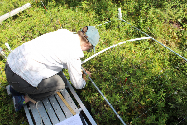
Vegetation survey data were collected at the peak of each growing season by placing a 1x2 meter rectangular grid over each community plot. The 1x2 meter grid is subset into 50 20x20 cm grid cells. Observations are of the presence of each species in each grid cell for each subplot. That’s a total of 39 subplots across the 13 experimental plots. From 2018 to 2020, shrub stem density was counted and percent shrub cover was estimated in five selected grid cells in each vegetation community plot. Also included are photographs of each community plot taken at the time of data collection for each measurement year. These data provide insight into the responses of plant community composition to warming and increased carbon dioxide. These data were use in analyses in McPartland et al (2018; 2020).
This dataset contains three data files in comma-separate values (*.csv) format and seven compressed (*.zip) files containing 877 JPEG (*.jpg) files. Additional metadata are provided: a data dictionary and a file-level metadata file in comma-separate values (.csv) format and a user guide in PDF (*.pdf) format.
Citation
McPartland, MY, ES Kane, MJ Falkowski, RK Kolka, MR Turetsky, B Palik, and RA Montgomery. 2019. SPRUCE Vegetation Community Survey Data from SPRUCE Experimental Plots, 2014-2020. ORNL Terrestrial Ecosystem Science SFA, ESS-DIVE repository. Dataset. https://doi.org/10.25581/spruce.059/1499107
Posted
Tuesday, March 12, 2019
SPRUCE ID: spruce.059
Public
Click image to see full-sized version