SPRUCE Terrestrial Laser Scanning of Experimental Plots Beginning in 2015
Description
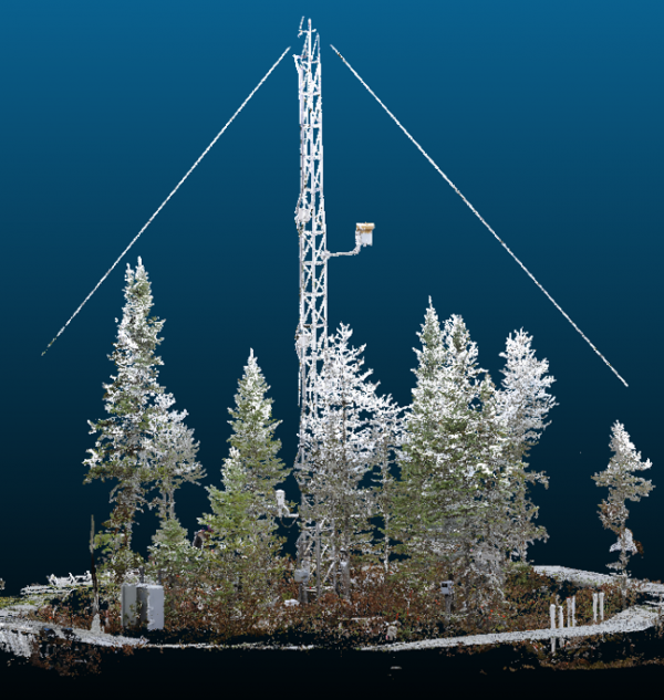
This data set comprises terrestrial laser scanning (TLS) point clouds from the SPRUCE experimental plots located in the S1-Bog of the Marcell Experimental Forest (MEF) near Grand Rapids, Minnesota. In 2015 and 2020, the 12 experimental SPRUCE plots were scanned near peak foliage ("summer”). In 2016-2019 and 2021-2023 the 12 plots were scanned prior to green up ("spring”) and once near peak foliage (Table 1). Additional data will be added through summer 2025.
A RIEGL VZ-1000 unit was used to collect all scans. Four TLS scans in each plot were registered to produce a single point cloud per plot using RiSCAN PRO v2.3 software. Up to six additional scans were registered to account for data occlusion when necessary. Point clouds are saved in LAS (*.las) 1.2 format. Point clouds were geo-registered to surveyed plot locations. There are 192 *.las files provided with this dataset.
Citation
Graham, J.D., N.F. Glenn, L.P. Spaete, J. Enterkine, & A. Seibert. 2019. SPRUCE Terrestrial Laser Scanning of Experimental Plots Beginning in 2015. Oak Ridge National Laboratory, TES SFA, U.S. Department of Energy, Oak Ridge, Tennessee, U.S.A. https://doi.org/10.25581/spruce.067/1515552.
Download
Posted
Monday, September 9, 2019
SPRUCE ID: spruce.067
Public
Click image to see full-sized version