SPRUCE Microtopography of Experimental Plots Derived from Terrestrial Laser Scans Beginning in 2016
Description
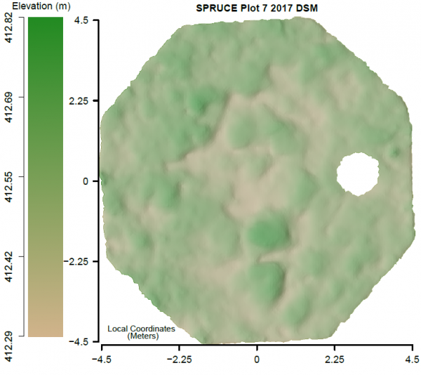
This dataset consists of maps and summaries of very high resolution (1 cm2) spatial data derived from terrestrial laser scans (TLS) characterizing the microtopography (hummocks and hollows) in 12 SPRUCE experimental plots from 2016-2018. The SPRUCE experiment is located in the S1-Bog of the Marcell Experimental Forest (MEF) near Grand Rapids, Minnesota. Additional data will be added through Summer 2021.
In the spring of each year, four TLS scans were taken per plot/enclosure and registered together to produce a single point cloud for each plot. Digital surface models (DSMs) were generated from the point clouds and clipped to the inside boundary of the boardwalk in each plot resulting in an approximately 9 x 9 m study area.
All other characterization data types were derived from plot DSMs (elevation), including: slope, concavity, index used for microform classification (Hollow Index), and microforms (hummocks and hollows) classified using three methodologies.
Citation
Graham, J.D., N.F. Glenn, L P. Spaete. 2019. SPRUCE Microtopography of Experimental Plots Derived from Terrestrial Laser Scans Beginning in 2016. Oak Ridge National Laboratory, TES SFA, U.S. Department of Energy, Oak Ridge, Tennessee, U.S.A. https://doi.org/10.25581/spruce.068/1515553
Download
Posted
Friday, September 20, 2019
SPRUCE ID: spruce.068
Public
Click image to see full-sized version